Highly imaginative in concept, bold in its approach, ingenious in planning and beneficial on its completion, this inter state, multi purpose, multi valley project is truly a unique one. It successfully accomplishes the diversion and integration of 8 West flowing rivers, 6 in the Anaimalai Hills and 2 in the plains for the benefit of the drought prone areas in the Coimbatore and Erode district of Tamilnadu State and stabilizing the existing irrigation system in Chittoorpuzha of Kerala State. Dams on the 8 rivers with inter connecting tunnels have been constructed. The tunnels divert the waters impounded in the rivers to the plains of the Coimbatore District and Erode District of Tamilnadu State and Chittur area of the Kerala State.

The reservoirs lie at various elevations ranging between elevation + 3800 feet and + 1050ft. and this difference of elevations has made it possible to utilize the drop between them for the development of hydro-electric power

This project is an outcome of a hard and sustained work done by a band of enthusiastic engineers. This is situated in Anaimalais range amongst its flora and fauna and on the arid and semi arid plains of the southern taluks of Coimbatore District. All the river, which has its source in the Anamalai range, is served by the South-West Monsoon. The Major portion of the Dams and Tunnels are located in the scenic and scene surrounding of the Anaimalai range and the reservoirs are located amongst picturesque and natural surroundings in the Reserved forest areas and Tea Estates. This project takes its name after the two important rivers (1) Parambikulam representing the series of river on the west (2) Aliyar representing the east of Western Ghats. In a sense this project is a symbol of Inter-State Co-operation of the two neighborly State of Kerala and Tamil nadu. An agreement in this regard was signed by the two states 1969 and also in the year 1970.
This multi purpose project has got a long history. The main components of this project comprises of 10 Dams, 4 Power Houses, 6 Main Tunnels and 7 irrigation canals. the project was executed by Govt of Tamil Nadu during 1958 and 1990. The project has Culturable command area of 1.74 lakh hectare (1.01 lakh ha original and 0.73 lakh ha under extension and four power houses with installed capacity of 185 MW.
DAMS :
UPPER NIRAR WEIR :

The Nirar River takes its source from the Kattamalai Hills, and takes the name of Kallar, subsequently after its confluence with some of the streams. It runs in a South Westerly Direction and falls into Edamalayar, the major tributary of Periyar river. The first work done in the highest elevation in Tamilnadu is the Upper Nirar Weir with a catchment area of 29 square miles. (75.2sqm). The F.R.L. is EL+3800 ft. Water will be diverted from this weir though the Upper Nirar Tunnel to the adjacent Sholayar Basin.
LOWER NIRAR DAM :

A dam across Nirar River at a lower site, about 8 km, below the Upper Nirar weir has been constructed. This dam will serve to conduct the diverted waters of Anaimalaiyar Basin (yet to begin) to the Sholayar valley through the un-lined lower Tunnel taking off from the dam site. In addition to this, the yield of the catchment between the Upper Nirar Weir and the Dam will also be diverted to the Sholayar Basin.
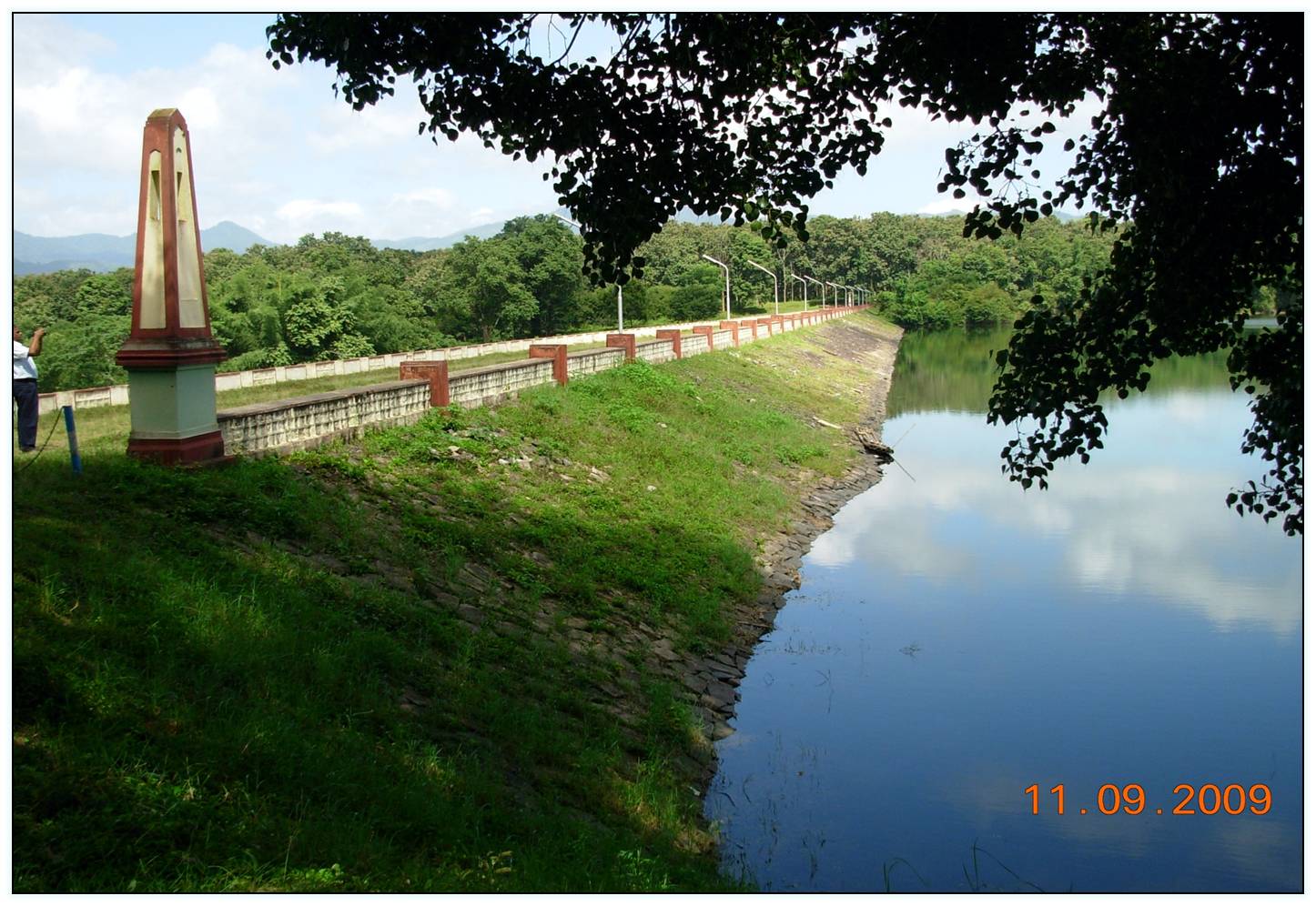
SHOLAYAR RESERVOIR :

Sholayar River is one of the main tributaries of Chalakudi river. It has its source in Valparai Estate and runs in a westerly direction fore about 30 miles before it joins the Parambikulam River. The total catchment area of this river upto its in-fall into Parambikulam river is 100 sq.miles of which 55 sq.miles is in the TamilNadu State and the rest in Kerala. The Upper catchment of this river is situated at an elevation from 3000 to 8000 ft. This influenced by the South West Monsoon.
The Sholayar dam constructed (maximum height 345 ft) across the river Sholayar has a capacity of 5392 Mcft. Incidentally this is the highest Dam in Tamil Nadu. This reservoir, after meeting the requirements of the Kerala State, will divert about 2,500 mcft to the Parambikulam Aliyar Project system through the Sholayar Tunnel-1. In Addition to this, the waters received from the Nirar and Anamalayar Valleys will also be diverted to the adjacent Parambikulam valley through the tunnel. The water thus diverted passes through Power House No.-1 and it is utilised for power generation. The water that is supplied to the Kerala Sholayar Reservoir is also utilised for Power Generation through Power House No-2. The installed power generation in Power House No.I is 70 M.W. and Power House No.II is 25 M.W.
ANAMALAYAR DIVERSION WORK :
Under this proposal a diversion of 2,500 Mcft. each year from Anamalayar for use in the Parambikulam Aliyar Project system has been agreed by the Kerala Government and the scheme proposals are awaiting clearance from Kerala Government. This work will be taken up after it is cleared by the Kerala Government and a supplemental agreement is concluded on this aspect.
PARAMBIKULAM RESERVOIR :

Parambikulam River has its origin in Ramakrishna Malai with the name of Periyar at an elevation 4,000 to 5,000 ft in Coimbatore District. Three tributaries join this Parambikulam River along its run. Parambikulam Reservoir is the largest Reservoir of the Project with a gross storage capacity of about 17,820 Mcft. At F.R.L. + 1825 ft. Water from this reservoir is diverted to the adjacent Thunacadavu Reservoir a Balancing Reservoir through the Parambikulam Tunnel which is 8186 ft. in length. the dam is located in Kerala territory.
THUNACADAVU RESERVOIR :

This is a small balancing Reservoir constructed across Thunacadavu River, which is a tributary of Parambikulam River. It’s gross capacity is 557 Mcft. The water that is received from Prambikulam Reservoir and from the Peruvaripallam Reservoir, as well as from its own catchment, is diverted to the Sarkarpathy Power House through the Sarkarpathy Power Tunnel.
PERUVARIPALLAM RESERVOIR :

This Reservoir is formed by an earthen Dam 1535 feet in length and has a gross capacity of 620 Mcft. This is connected to the Thunacadavu Reservoir by an open cut channel. The combined catchment area of Thunacadavu River Peruvaripallam is 22.80 sq miles at the Dam Site.
ALIYAR RESERVOIR :

The Aliyar River has its source in the Anamalai Hills. It flows in a northwesterly direction for about 14 miles before it enters the plains. It is joined by Uppar on its left and Palar River on its right. This river has got an old Ayacut of 2505 ha of wetlands, through a system of 5 anicuts. The last anicut in the series is Vadakalur anicut and below it there are 4 major anicut in Kerala State irrigating an area of 8058 ha. The catchment area of this river at the last Anicut in Kerala State is 419 sq.miles of which 366 sq.miles is in Tamil Nadu State.
A Reservoir has been formed by construction of a dam across the River Aliyar and it has a gross capacity of 3,864 Mcft. Two irrigation canal i.e., Vettaikaranpudur and Pollachi canal take off from this Reservoir. This reservoir is also intended to meet the requirements of the existing command area in Tamil Nadu State and Kerala State. The catchments area at Aliyar Dam site is 76 sq.miles.
THIRUMURTHY RESERVOIR :

This reservoir has been constructed across the River Palar, which has got its origin at the northern slopes of Anamalai Hills. It is a tributary of Aliyar. About 5 miles below the origin of Palar there exists an Old Anicut called Dhali anicut which has got open head channels and irrigated about 1120 ha of which 70 ha are under direct irrigation and rest is through a system of 7 tanks. This reservoir has got its name of Thirumurthy Reservoir because of the existence of waterfall and a Temple nearby the Dam site by that name. This reservoir across the River Palar has a gross capacity of 1,935 Mcft. Apart from its own catchment it receives the diverted water from the Uppar Reservoir in the Anamalai Range, through the Sarkarpathy tunnel and the Contour Canal. An irrigation Canal called, the Parambikulam, Main Canal takes off from this Reservoir and it branches into two.
a) A 125 km Long Parambikulam Main Canal and
b) A 30.4 km long Udumalpet Canal
The Parambikulam main Canal is the biggest and longest irrigation canal under this project with an ayacut of . This reservoir also stabilizes irrigation for the Old Ayacut of about 1050 ha under Dhali system of Palar. A High-level canal to feed 1002 ha also takes off from Reservoirs.
UPPER ALIYAR RESERVOIR :
A 235 feet high dam across Aliyar called the Upper Aliyar Dam has been constructed just above the Aliyar Dam and is mainly intended for generation of power through a Power House situated in the foreshore of the Aliyar Reservoir.
UPPAR DAM:

In addition to above works, a dam at Uppar in the plains at Daharapuram taluk has also been constructed to catch the return flow estimated at about 10% of the discharges in the Parmbikulam main canal to irrigate 2426 hectare.
TUNNEL:
UPPER NIRAR TUNNEL :
This tunnel connecting Upper Nirar Weir to TN Sholayar dam basin.Tunnel is of horse shoe shape, 20 feet in diameter and 4266m long and designed for a discharge of 2670 Cusecs.During October to January water will be let down in the river coarse itself to supply water to Kerala.other than this period water will be supplied to Sholayar basin via this tunnel.The sill of tunnel exit is the FRL of d/s dam.
LOWER NIRAR TUNNEL;
This tunnel connects the Lower Nirar Dam with the Sholayar basin is unlined is of ‘D’ shape, 22 feet in diameter and 8129m long. It is designed for a discharge of 2200 cusecs. The sill of tunnel exit is the FRL of d/s dam.
SHOLAYAR TUNNEL:
This Sholayar tunnel inter-connects the Sholayar basin is unlined is of ‘D’ shape, 3.2 m in diameter and 2557m long. It is designed for a discharge of 850 cusecs.
PARAMBIKULAM TUNNEL:
The Parambikulam Tunnel connects the Parambikulam Reservoir to the Thunacadavu Reservoir in the adjacent valley. It is unlined, horseshoe shape, 5.1 m in diameter and 2495m long. It is designed for 1400 cusecs.
SARKARPATHY TUNNEL:

Sarkarpathy Tunnel diverts the waters from Thunacadavu Reservoir to the Sarkarpathy Power House. It is concrete lined and is horse shoe in shape of 3.65m in diameter and 3850m in length and designed for a discharge of 1400 cusecs.
NAVAMALAI TUNNEL:

Navamalai Tunnel carries the Contour Canal from Sarkarpthy power House to the Thirumurthy Dam for this particular each. This is a concrete lined tunnel and is of horseshoe shape, 14’3 in diameter and 15923 feet in length. It is designed to carry a discharge of 1,150 cusecs.
POWER HOUSES:
The total installed capacity of the four Power Houses of this project is 185 MW.
SHOLAYAR POWER HOUSE NO. I:
The fall of 1327 feet at the end of Sholayar Tunnel in utilized for generating power with an installed capacity of 70 MW.
POWER HOUSE NO. II:
A head of 508 feet below the Sholayar Dam has been used to develop 25 MW of Power from the waters released to the Kerala Reservoir.
SARKARPAHTY POWER HOUSE :
A drop of 326 feet at the end of Sarkarpathy Tunnel is being utilized for generation 30 MW of power.
ALIYAR POWER HOUSE (NAVAMALAI):
A fall of 1400 feet available in the Aliyar Valley between Upper and Lower Aliyar Reservoir is utilized for generating 60 MW of Power.
CANALS:
The peculiarity this project is that the entire canal system is lined with concrete, even initially, during execution itself, to prevent seepage losses. There are seven irrigation canals, excluding the Contour Canal, which carries the discharge from the Parambikulam group of Reservoirs diverted at Sarkarpathy to Thirumurthy Dam. They are:-
a. Aliyar Feeder Canal: 13.400 Km long with a carrying capacity of 8 cumec serving an ayacut to 1941 ha, in addition feeding Aliyar Reservoir.
b. Sethumadai Canal: 8.2 Km. long with 2 cumec carrying capacity serving an ayacut of 2060 ha.
c. Pollachi Canal: 48 Km. long with a carrying capacity of 8.5 cumec and serving an area of 9474 ha.
d. Vettaikaranpudur Canal: 17.2Km. long with a carrying capacity of 3 cumec and serving area of 4540 ha.
e. Parambikulam Main Canal: This canal is the longest and the biggest Canal. It is 124 Km. in Length and is designed to carry a discharge of 29 cumec for Irrigating an area of 1,25,160 ha.
f. Udumalpet Canal: 38 Km. long is designed to carry discharge of 8 cumec for irrigating an area of 27,516 ha.
g. High Level Canal: The Length of the canal is 2.00 K.M and designed to irrigate an area of 1002 ha
CONTOUR CANAL :
This Contour Canal is unique of its kind in the whole of South India. This canal is designed to take tailrace waters from the Sarkarpathy Power House and feed Thirumurthy Dam. During it’s run of about 52 Km. it passes through 4 tunnels of which Navamalai is the longest one. Its carrying capacity is 1,150 cusecs. The execution of this canal is an engineering achievement. It has been constructed against heavy odds in a very difficult terrain amidst forest area involving Rock cutting on one side and fitting on other side. The Contour Canal is about 49.30 Km. in length and is designed to carry a discharge of 1,150 cusecs. As already stated, the Contour Canal connects Sarkarpathy Power House to the Thirumurthy Dam and runs through a difficult terrain. A Aliyar feeder canal also takes off which feed into Aliyar dam.

The lifeline of Tens of Thousands of farmers !
..............Really a GIFT TO OUR NATION.
THANK YOU
WITH KIND
LEELA.G

The reservoirs lie at various elevations ranging between elevation + 3800 feet and + 1050ft. and this difference of elevations has made it possible to utilize the drop between them for the development of hydro-electric power

This project is an outcome of a hard and sustained work done by a band of enthusiastic engineers. This is situated in Anaimalais range amongst its flora and fauna and on the arid and semi arid plains of the southern taluks of Coimbatore District. All the river, which has its source in the Anamalai range, is served by the South-West Monsoon. The Major portion of the Dams and Tunnels are located in the scenic and scene surrounding of the Anaimalai range and the reservoirs are located amongst picturesque and natural surroundings in the Reserved forest areas and Tea Estates. This project takes its name after the two important rivers (1) Parambikulam representing the series of river on the west (2) Aliyar representing the east of Western Ghats. In a sense this project is a symbol of Inter-State Co-operation of the two neighborly State of Kerala and Tamil nadu. An agreement in this regard was signed by the two states 1969 and also in the year 1970.
This multi purpose project has got a long history. The main components of this project comprises of 10 Dams, 4 Power Houses, 6 Main Tunnels and 7 irrigation canals. the project was executed by Govt of Tamil Nadu during 1958 and 1990. The project has Culturable command area of 1.74 lakh hectare (1.01 lakh ha original and 0.73 lakh ha under extension and four power houses with installed capacity of 185 MW.
DAMS :
UPPER NIRAR WEIR :

The Nirar River takes its source from the Kattamalai Hills, and takes the name of Kallar, subsequently after its confluence with some of the streams. It runs in a South Westerly Direction and falls into Edamalayar, the major tributary of Periyar river. The first work done in the highest elevation in Tamilnadu is the Upper Nirar Weir with a catchment area of 29 square miles. (75.2sqm). The F.R.L. is EL+3800 ft. Water will be diverted from this weir though the Upper Nirar Tunnel to the adjacent Sholayar Basin.
LOWER NIRAR DAM :

A dam across Nirar River at a lower site, about 8 km, below the Upper Nirar weir has been constructed. This dam will serve to conduct the diverted waters of Anaimalaiyar Basin (yet to begin) to the Sholayar valley through the un-lined lower Tunnel taking off from the dam site. In addition to this, the yield of the catchment between the Upper Nirar Weir and the Dam will also be diverted to the Sholayar Basin.
SHOLAYAR RESERVOIR :

Sholayar River is one of the main tributaries of Chalakudi river. It has its source in Valparai Estate and runs in a westerly direction fore about 30 miles before it joins the Parambikulam River. The total catchment area of this river upto its in-fall into Parambikulam river is 100 sq.miles of which 55 sq.miles is in the TamilNadu State and the rest in Kerala. The Upper catchment of this river is situated at an elevation from 3000 to 8000 ft. This influenced by the South West Monsoon.
The Sholayar dam constructed (maximum height 345 ft) across the river Sholayar has a capacity of 5392 Mcft. Incidentally this is the highest Dam in Tamil Nadu. This reservoir, after meeting the requirements of the Kerala State, will divert about 2,500 mcft to the Parambikulam Aliyar Project system through the Sholayar Tunnel-1. In Addition to this, the waters received from the Nirar and Anamalayar Valleys will also be diverted to the adjacent Parambikulam valley through the tunnel. The water thus diverted passes through Power House No.-1 and it is utilised for power generation. The water that is supplied to the Kerala Sholayar Reservoir is also utilised for Power Generation through Power House No-2. The installed power generation in Power House No.I is 70 M.W. and Power House No.II is 25 M.W.
ANAMALAYAR DIVERSION WORK :
Under this proposal a diversion of 2,500 Mcft. each year from Anamalayar for use in the Parambikulam Aliyar Project system has been agreed by the Kerala Government and the scheme proposals are awaiting clearance from Kerala Government. This work will be taken up after it is cleared by the Kerala Government and a supplemental agreement is concluded on this aspect.
PARAMBIKULAM RESERVOIR :

Parambikulam River has its origin in Ramakrishna Malai with the name of Periyar at an elevation 4,000 to 5,000 ft in Coimbatore District. Three tributaries join this Parambikulam River along its run. Parambikulam Reservoir is the largest Reservoir of the Project with a gross storage capacity of about 17,820 Mcft. At F.R.L. + 1825 ft. Water from this reservoir is diverted to the adjacent Thunacadavu Reservoir a Balancing Reservoir through the Parambikulam Tunnel which is 8186 ft. in length. the dam is located in Kerala territory.
THUNACADAVU RESERVOIR :

This is a small balancing Reservoir constructed across Thunacadavu River, which is a tributary of Parambikulam River. It’s gross capacity is 557 Mcft. The water that is received from Prambikulam Reservoir and from the Peruvaripallam Reservoir, as well as from its own catchment, is diverted to the Sarkarpathy Power House through the Sarkarpathy Power Tunnel.
PERUVARIPALLAM RESERVOIR :
This Reservoir is formed by an earthen Dam 1535 feet in length and has a gross capacity of 620 Mcft. This is connected to the Thunacadavu Reservoir by an open cut channel. The combined catchment area of Thunacadavu River Peruvaripallam is 22.80 sq miles at the Dam Site.
ALIYAR RESERVOIR :

The Aliyar River has its source in the Anamalai Hills. It flows in a northwesterly direction for about 14 miles before it enters the plains. It is joined by Uppar on its left and Palar River on its right. This river has got an old Ayacut of 2505 ha of wetlands, through a system of 5 anicuts. The last anicut in the series is Vadakalur anicut and below it there are 4 major anicut in Kerala State irrigating an area of 8058 ha. The catchment area of this river at the last Anicut in Kerala State is 419 sq.miles of which 366 sq.miles is in Tamil Nadu State.
A Reservoir has been formed by construction of a dam across the River Aliyar and it has a gross capacity of 3,864 Mcft. Two irrigation canal i.e., Vettaikaranpudur and Pollachi canal take off from this Reservoir. This reservoir is also intended to meet the requirements of the existing command area in Tamil Nadu State and Kerala State. The catchments area at Aliyar Dam site is 76 sq.miles.
THIRUMURTHY RESERVOIR :

This reservoir has been constructed across the River Palar, which has got its origin at the northern slopes of Anamalai Hills. It is a tributary of Aliyar. About 5 miles below the origin of Palar there exists an Old Anicut called Dhali anicut which has got open head channels and irrigated about 1120 ha of which 70 ha are under direct irrigation and rest is through a system of 7 tanks. This reservoir has got its name of Thirumurthy Reservoir because of the existence of waterfall and a Temple nearby the Dam site by that name. This reservoir across the River Palar has a gross capacity of 1,935 Mcft. Apart from its own catchment it receives the diverted water from the Uppar Reservoir in the Anamalai Range, through the Sarkarpathy tunnel and the Contour Canal. An irrigation Canal called, the Parambikulam, Main Canal takes off from this Reservoir and it branches into two.
a) A 125 km Long Parambikulam Main Canal and
b) A 30.4 km long Udumalpet Canal
The Parambikulam main Canal is the biggest and longest irrigation canal under this project with an ayacut of . This reservoir also stabilizes irrigation for the Old Ayacut of about 1050 ha under Dhali system of Palar. A High-level canal to feed 1002 ha also takes off from Reservoirs.
UPPER ALIYAR RESERVOIR :
A 235 feet high dam across Aliyar called the Upper Aliyar Dam has been constructed just above the Aliyar Dam and is mainly intended for generation of power through a Power House situated in the foreshore of the Aliyar Reservoir.
UPPAR DAM:

In addition to above works, a dam at Uppar in the plains at Daharapuram taluk has also been constructed to catch the return flow estimated at about 10% of the discharges in the Parmbikulam main canal to irrigate 2426 hectare.
TUNNEL:
UPPER NIRAR TUNNEL :
This tunnel connecting Upper Nirar Weir to TN Sholayar dam basin.Tunnel is of horse shoe shape, 20 feet in diameter and 4266m long and designed for a discharge of 2670 Cusecs.During October to January water will be let down in the river coarse itself to supply water to Kerala.other than this period water will be supplied to Sholayar basin via this tunnel.The sill of tunnel exit is the FRL of d/s dam.
LOWER NIRAR TUNNEL;
This tunnel connects the Lower Nirar Dam with the Sholayar basin is unlined is of ‘D’ shape, 22 feet in diameter and 8129m long. It is designed for a discharge of 2200 cusecs. The sill of tunnel exit is the FRL of d/s dam.
SHOLAYAR TUNNEL:
This Sholayar tunnel inter-connects the Sholayar basin is unlined is of ‘D’ shape, 3.2 m in diameter and 2557m long. It is designed for a discharge of 850 cusecs.
PARAMBIKULAM TUNNEL:
The Parambikulam Tunnel connects the Parambikulam Reservoir to the Thunacadavu Reservoir in the adjacent valley. It is unlined, horseshoe shape, 5.1 m in diameter and 2495m long. It is designed for 1400 cusecs.
SARKARPATHY TUNNEL:

Sarkarpathy Tunnel diverts the waters from Thunacadavu Reservoir to the Sarkarpathy Power House. It is concrete lined and is horse shoe in shape of 3.65m in diameter and 3850m in length and designed for a discharge of 1400 cusecs.
NAVAMALAI TUNNEL:

Navamalai Tunnel carries the Contour Canal from Sarkarpthy power House to the Thirumurthy Dam for this particular each. This is a concrete lined tunnel and is of horseshoe shape, 14’3 in diameter and 15923 feet in length. It is designed to carry a discharge of 1,150 cusecs.
POWER HOUSES:
The total installed capacity of the four Power Houses of this project is 185 MW.
SHOLAYAR POWER HOUSE NO. I:
The fall of 1327 feet at the end of Sholayar Tunnel in utilized for generating power with an installed capacity of 70 MW.
POWER HOUSE NO. II:
A head of 508 feet below the Sholayar Dam has been used to develop 25 MW of Power from the waters released to the Kerala Reservoir.
SARKARPAHTY POWER HOUSE :
A drop of 326 feet at the end of Sarkarpathy Tunnel is being utilized for generation 30 MW of power.
ALIYAR POWER HOUSE (NAVAMALAI):
A fall of 1400 feet available in the Aliyar Valley between Upper and Lower Aliyar Reservoir is utilized for generating 60 MW of Power.
CANALS:
The peculiarity this project is that the entire canal system is lined with concrete, even initially, during execution itself, to prevent seepage losses. There are seven irrigation canals, excluding the Contour Canal, which carries the discharge from the Parambikulam group of Reservoirs diverted at Sarkarpathy to Thirumurthy Dam. They are:-
a. Aliyar Feeder Canal: 13.400 Km long with a carrying capacity of 8 cumec serving an ayacut to 1941 ha, in addition feeding Aliyar Reservoir.
b. Sethumadai Canal: 8.2 Km. long with 2 cumec carrying capacity serving an ayacut of 2060 ha.
c. Pollachi Canal: 48 Km. long with a carrying capacity of 8.5 cumec and serving an area of 9474 ha.
d. Vettaikaranpudur Canal: 17.2Km. long with a carrying capacity of 3 cumec and serving area of 4540 ha.
e. Parambikulam Main Canal: This canal is the longest and the biggest Canal. It is 124 Km. in Length and is designed to carry a discharge of 29 cumec for Irrigating an area of 1,25,160 ha.
f. Udumalpet Canal: 38 Km. long is designed to carry discharge of 8 cumec for irrigating an area of 27,516 ha.
g. High Level Canal: The Length of the canal is 2.00 K.M and designed to irrigate an area of 1002 ha
CONTOUR CANAL :
This Contour Canal is unique of its kind in the whole of South India. This canal is designed to take tailrace waters from the Sarkarpathy Power House and feed Thirumurthy Dam. During it’s run of about 52 Km. it passes through 4 tunnels of which Navamalai is the longest one. Its carrying capacity is 1,150 cusecs. The execution of this canal is an engineering achievement. It has been constructed against heavy odds in a very difficult terrain amidst forest area involving Rock cutting on one side and fitting on other side. The Contour Canal is about 49.30 Km. in length and is designed to carry a discharge of 1,150 cusecs. As already stated, the Contour Canal connects Sarkarpathy Power House to the Thirumurthy Dam and runs through a difficult terrain. A Aliyar feeder canal also takes off which feed into Aliyar dam.

The lifeline of Tens of Thousands of farmers !
..............Really a GIFT TO OUR NATION.
THANK YOU
WITH KIND
LEELA.G
Amma, intha adhisayathai indru neril sendru paarthu vanden.Athan pin, thangal katturayai padithen.Mechinen.
ReplyDeleteHi maam...well written
ReplyDeleteare u the one as axe to the parampikulam project?
Superb...mam. Its easier to gather the complete overview.
ReplyDeletewell presented. it is a very much an intelectual engg feet done by our Indian Engineers. The farmers of of Coimbatore and Erode bless us all
ReplyDeletevery nice narration... kudos to your intellect for the inputs in a manner well understood the story but to add one thing that it is not only an engineers but geologist of GSI played important role in selection of site and analysing routes which will be best feasible with less geological complexity be it tunnels or open canals or weir location to just exemplify the statement
ReplyDeleteBetter you give credit to all Geotechical Professionals associated with the projects
Leela, probably the best writeup on the Parambikulam Aliyar project that I found online. Appreciate this post and the effort you have taken to understand the entire project. Most people have forgotten the complexity involved and imagine water comes in a canal from a dam. Wonder if you found material on the engineers and planners.
ReplyDelete